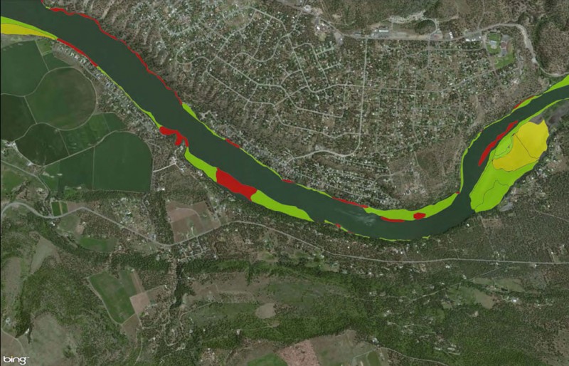
AquaTechnex has a complete Geographic Information System (GIS) facility staffed to assist in the analysis of lake and aquatic plant management issues. Our mapping vessels are state of the art equipped with ArcGIS and Trimble systems to collect data and monitor change in response to treatment prescriptions we implement.
Aquatechnex mapped invasive aquatic weeds along 50 miles of shoreline on this project. This type of data is useful in designing management programs and tracking results as they are implemented.
Learn More About AquatiClear by Kasco
To learn more, please fill out the form on this page. You can also call us toll-free at (855) 245-LAKE (5253).